8 Days

Northern Circuit Route

Overview

Mount Kilimanjaro

The 8-day Northern Circuit Route on Mount Kilimanjaro offers breathtaking scenery and excellent acclimatization. Beginning at Londorossi Gate, it traverses lush rainforests, high-altitude moorlands, and barren alpine deserts. 

Highlights include the scenic Shira Plateau, Barranco Wall, and the summit push via Barafu Camp. Trekkers witness stunning sunrises at Uhuru Peak, the highest point in Africa. The route ends with a descent through vibrant rainforests to Mweka Gate, offering a memorable adventure for climbers of all levels.

No of Days

8 Days | 7 Nights

Area to Visit

 Mti Mkubwa Camp, Shira Camp Moir Camp, Pofu/Buffalo Camp, Third Cave Camp, School Hut Camp, Uhuru Peak and Mweka Camp  

Full Itinerary

Day by Day

We will depart from our hotel in Arusha and drive for 3hrs (approx.) to the starting point, where we will do the registration, lunch and weigh all our luggages, food and equipment. As we get the permit from the park wardens we will start hiking from this point to our first camp.

This day we walk through one of the most beautiful areas of Kilimanjaro, with special flora and fauna.

The day ends in "Mti Mkubwa", which is Kiswahili for "Big Tree" camp (2,785 m), where your tent is already set up and a snack and hot drink is waiting for you.

At night you can enjoy the many sounds of the forest.

Distance 4.8 km
Altitude difference 396 m
Starting point 2,389 m
Miti Mkubwa 2,785 m

Day 2 of the climb is the most varied of the tour in terms of vegetation. Just like yesterday, we walk the first part through the rainforest (about 1 ½), but soon we leave the trees behind us and we walk between the wildflowers of the giant heather zone.

We walk across the Shira ridges to Shira 1 Camp where the camp is located in the Shira plateau. Since we are above 3,000 meters you will already feel the reduced oxygen pressure. The guide will therefore intentionally adopt a slower pace to help you acclimatize.

Still climbing, we eventually walk along the northern slopes of the Shira Ridge - Kilimanjaro's lesser-known third peak. From here you already have a beautiful view of the top of Kilimanjaro, also known as Kibo peak.

Distance 7.9 km
Altitude difference 825 m
Mti Mkubwa Camp 2,785 m
Shira Camp 3,610 m

The morning hike will start from Shira 1 Camp to Moir camp which will take us 10km hike and we will have our snacks with us. If we are strong enough on the hike we can proceed all the way to the camp and have a hot lunch, but if you are slow pace hiker we can stop at fishers point and have hot lunch. From here we will hike for 1 ½ to Moir Camp. Arriving to the camp late in the afternoon will allow us to walk to the rock boulders around the camp to acclimatize more 200m above the camp. Considering the theme of Climb high Sleep Low

Option:

For the strong hikes who may arrive at the camp before lunch, they can enjoy their hot lunch at Moir Camp thereafter they will have a chance to acclimatize to Lava Tower 4600m

 Your mountain guide, through his extensive knowledge of the mountain, will advise you on which option you are capable with due to your previous walk pace. Also, the guide will advise you depending on the daily weather as to which option is best for you. This is all to make sure that everyone is able to acclimatize before moving to the next camp so as to give you all the best success on the summit day. For a group it is strongly advised to move together on any option that will be advised by the guide.

Since we stay overnight at 4,200 meters, it is not uncommon to feel some mild symptoms of altitude sickness, such as fatigue and headaches. Try to drink well (water, tea). Follow the advice of your guide.

Distance 10 km
Height difference 565 m
Shira Camp 3,600 m
Lava Tower 4,600 m
Moir Camp 4,165 m

From now on we will be actually on the northern route for two days and we will not encounter any more climbers from the southern routes (Machame, Lemosho, Umbwe). This is what makes the northern route so peaceful and therefore special. Today we climb to an altitude of 4,400 meters and then descend again to Pofu Camp which is located at 4,033 meters. Pofu means   Buffalo in Kiswahili. Today you will encounter many landscapes: valleys, Alpine landscapes, and moorland. To the north, you look out over Amboseli National Park located in Kenya, to the south the peak of Kilimanjaro.

Distance 10 km
Height difference - 132 m
Moir Camp 4,165 m
Pofu /Buffalo Camp 4,033 m 

We continue yesterday's path. The route goes up and down but we stay more or less at the same altitude today.

To our right we continue to look out for the Kibo Summit and Mawenzi gradually looms larger and larger in front of you, although you won't see much of the glorious saddle yet. (Mawenzi is the second peak of Mt. Kilimanjaro)

We spend the night in Third Cave Camp which is one of the overnight places of the eastern Rongai Route.

Distance 6.8 km
Height difference - 38 m
Pofu Camp 4,033 m
Third Cave Camp 3,995 m


After traversing the northern slopes of Kilimanjaro for the past two days at approximately the same elevation, today you will begin the climb up from Third Cave Camp to School Hut camp. Although the distance is shorter than the previous two days, the difference in height means that it will not be an easy climb. We arrive early in the afternoon.

We have a nice view over the saddle and Mawenzi Peak. Ask your guide to take you to the dead buffalo trail, well preserved and wedged between rocks just 100 meters from the main trail.

Arriving at the School Hut Camp we will have dinner in time to go to sleep as early as possible because we get up around 12 am for the Summit attempt. Before going to sleep, it is good to pack your backpack with extra things and have your warm clothes ready.

Don't worry about waking yourself up, the crew will do this. You probably don't feel like eating, but try to do so anyway, because you need the energy reserves.

Distance 4.9 km
Height difference - 805 m
Third Cave Camp 3,995 m
School Hut Camp 4,800 m

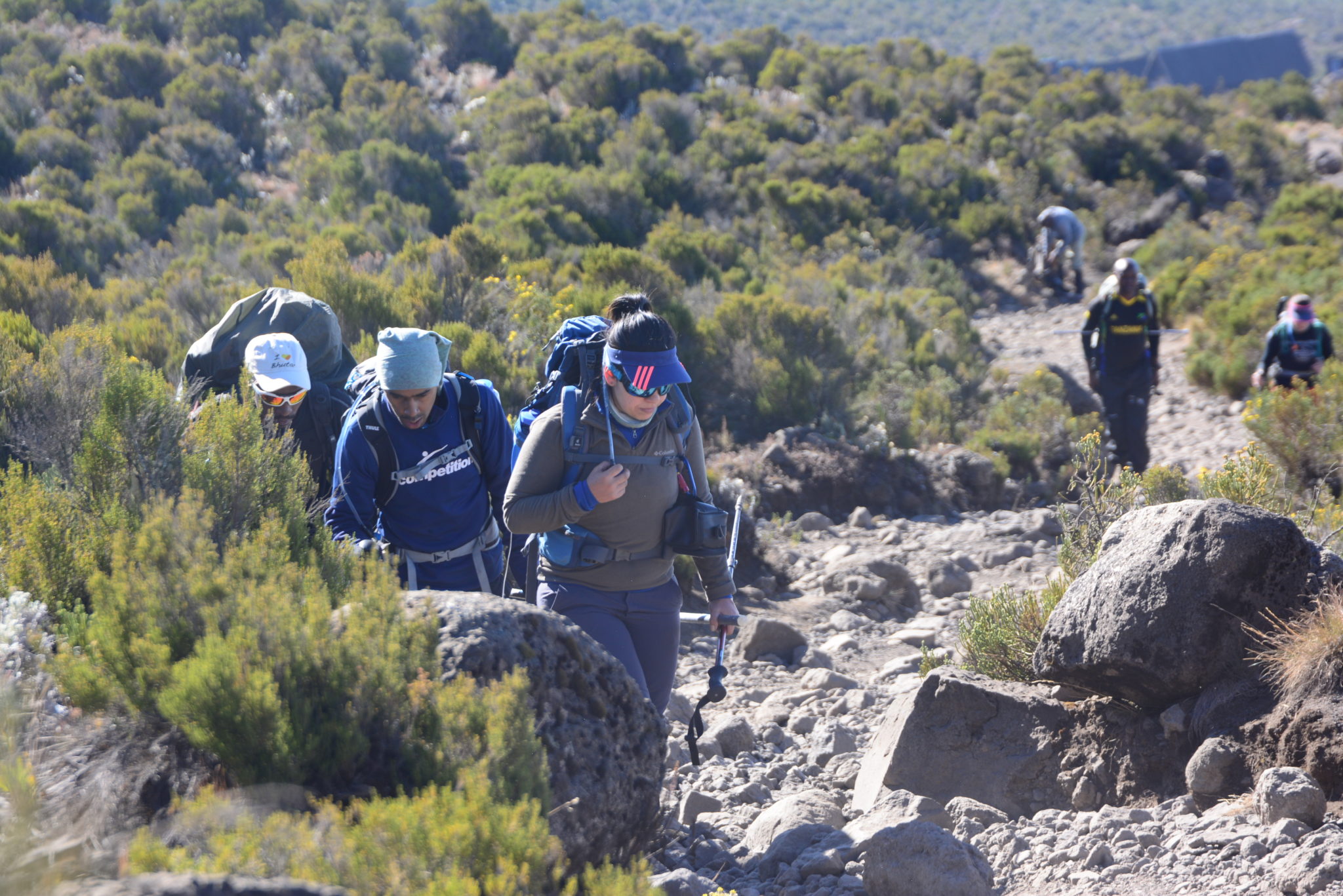
Around midnight (your guide will judge the optimal time for you based on your pace so far), you will leave the altitude camp for the Summit ascent via Gillman's Point. At Gillmans you may join other hikes from Marangu trail/ Coke Cola Route. The next few hours you will be hiking with the light of your flashlight. It will be a tough climb for many, especially the last 550 meters. You will sometimes feel like giving up, almost everyone has this, but with a little perseverance you will almost certainly reach the top Uhuru.The final push is always harder but on the mountain you need to stay positive to conquer your dream.

When resting, make sure to stand or sit alone and not lie down. Above all, rely on the guide; he has a lot of experience in judging whether someone can or should turn around further.

We avoid as much as possible the loose steep slopes above Kibo Hut and climb from School Hut Kamp via Hans Meyer Cave (5,259 m) and Gillman's Point (5,719 m), to Uhuru Peak (5,895 m).

Arriving at Gillman's Point we rest and eat and drink something. From this point it is only 200 vertical meters of climbing on a well-maintained path.

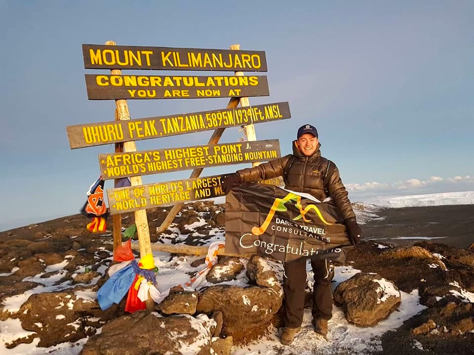
You are now on the roof of Africa! Enjoy this wonderful moment.

At the summit (the highest point in Africa) the guide will advise how much time you can spend there, taking into account your fitness level, your climbing time and the weather. The sunrise is beautiful so don't forget to take pictures.

We descend via Barafu Kamp (5,700 m) to Mweka Kamp (3,100 m) where we spend the night. We may have a stop at Barafu Camp or before for our snacks that we had carried in the night. This will also depend on your pace.

A well-deserved hot lunch is waiting for you in Millenium Camp (3827m), where you will meet all the crew whom have been with you during the whole trek. After lunch it is about a 2 to 2.5 hour walk to Mweka camp where you will spend the night.

Distance School Hut to Top 5.9 km
Distance Top to Mweka 10 km
Height difference climb 1,095 m
Height difference descent 2795 m
School Hut Camp 4,800 m
Uhuru Peak 5,895 m
Mweka Camp 3,100 m

Today we walk relaxed through the rainforest to the Mweka Park exit. Here we get our Kilimanjaro Certificate and have lunch.

We drive back to Arusha to your lodge for a well-deserved hot shower.

Distance 10 km
Height difference 1.467 m
Mweka Camp 3,100 m
Mweka Park Exit 1,633 m

Book this tour