8 Days

Lemosho Route

Overview

Mount Kilimanjaro

The Kilimanjaro climb 8 days lemosho is the best for acclimatization. The remote is less used and beautiful way up to the Shira Plateau.


The minimum duration for the Lemosho route is 6 days, however we strongly recommend hiking the route in 8 days. The additional 8th day will give your body more time to acclimatize, reducing the effects of altitude sickness and give you more time to rest before attempting the summit

No of Days

8 Days | 7 Nights

Area to Visit

Moshi, Londorossi Gate, Mti Mkubwa Camp, Shira Camp, Barranco Camp, Karanga Camp, Barafu Camp, Mweka Hut and Mweka Camp

Full Itinerary

Day by Day

After breakfast and briefing, drive to Londorossi Park Gate (3-hour drive). From here 4WD vehicle leads will pick you to Lemosho Glades. Walk along forest trails to Mti Mkubwa (big tree) campsite.

  • Elevation: 1830m/6000ft to 2650m/8700ft
  • Distance: 6km/4miles
  • Hiking Time: 2-3 hours
  • Habitat: Montane Forest
  • Meals: LD
  • Budget Lodging: Mti Mkubwa Camp

After breakfast, we continue as the trail gradually steepens and enters the giant heather moorland zone. After several streams are crossed we continue over the Shira Ridge then gently downwards to Shira 1 camp located by a stream on the Shira Plateau.

 
  • Elevation: 2650m/8700ft to 3500m/11,500ft
  • Distance: 8km/5miles
  • Hiking Time: 4-5 hours
  • Habitat: Moorland
    Meals: BLD
  • Budget Lodging: Shira 1 Camp.

After breakfast, a gentle hike across the plateau leads to Shira 2 camp on moorland meadows by a stream. A variety of hikes are available on the Plateau, making this an excellent acclimatization day.

  • Elevation: 3500m/11,500ft to 3850m/12,600ft
  • Distance: 8km/5miles
  • Hiking Time: 4-5 hours
  • Habitat: Moorland
  • Meals: BLD
  • Budget Lodging: Shira 2 Camp

From the Shira Plateau we continue to the east up a ridge, passing the junction towards the peak of Kibo. As we continue, our direction changes to the South East towards the Lava Tower, called the “Shark’s Tooth” (elevation 4650m/15,250ft). Shortly after the tower we come to the second junction, which goes to the Arrow Glacier. We now continue down to the Barranco Camp. Although you end the day around the same elevation, as when you began, this day is very important for acclimatization and will help your body prepare for summit day.

  • Elevation: 3850m/12,600ft to 4000m/13,000ft
  • Distance: 8km/5miles
  • Walking Time: 5-6 hours
  • Habitat: Semi-desert
  • Meals: BLD
  • Budget Lodging: Barranco Camp.

After breakfast, we will leave Barranco and continue on a steep ridge up the Barranco Wall to the Karanga Valley and to the junction, which connects the Mweka Trail.

  • Elevation: 4000m/13,000ft to 4050m/13,250ft
  • Distance: 5km/3miles
  • Hiking Time: 34 hours
  • Habitat: Alpine Desert
  • Meals: BLD
  • Budget Lodging: Karanga Valley Camp

We continue up to the Barafu Camp. South Circuit will be completed, which offers views of the summit from many different angles. Here we make camp, rest, enjoy dinner, and prepare for the summit day.

  • Elevation: 4050m/13,250ft to 4700m/15,350ft
  • Distance: 4km/2miles
  • Hiking Time: 3-4 hours
  • Habitat: Alpine Desert
  • Meals: BLD
  • Budget Lodging: Barafu Camp.
 

Very early in the morning (midnight to 2am), we continue our way to the summit between the Rebmann and Ratzel glaciers. You head in a northwesterly direction and ascend through heavy scree towards Stella Point on the crater rim. This is the most mentally and physically challenging portion of the trek.

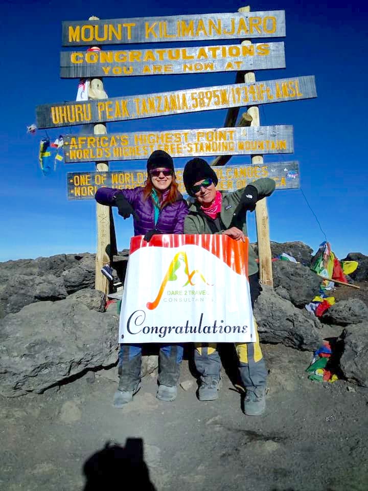
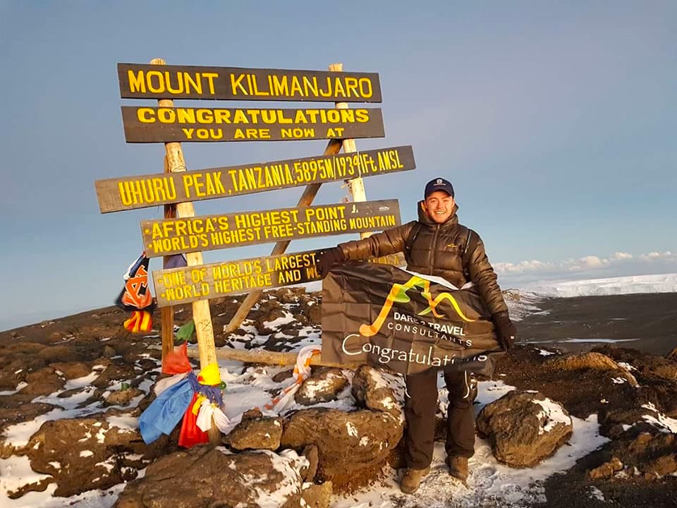
At Stella Point (18,600 ft), you will stop for a short rest and will be rewarded with the most magnificent sunrise you are ever likely to see (weather permitting). From Stella Point, you may encounter snow all they way on your 1-hour ascent to the summit. At Uhuru Peak, you have reached the highest point on Mount Kilimanjaro and the continent of Africa. Faster hikers will see the sunrise from the summit.

From the summit, we now make our descent continuing straight down to the Mweka Hut camp site, stopping at Barafu for lunch. You will want gaiters and trekking poles for the loose gravel going down. Mweka Camp is situated in the upper forest and mist or rain can be expected in the late afternoon. Later in the evening, we enjoy our last dinner on the mountain and a well-earned sleep.

  • Elevation (ft): 15,300ft to 19,345ft (and down to 10,000ft)
  • Distance: 5 km ascent / 12 km descent
  • Hiking Time: 7-8 hours ascent / 4-6 hours descent
  • Habitat: Arctic


After breakfast, we continue the descent down to the Mweka Park Gate to receive your summit certificates. At lower elevations, it can be wet and muddy. Gaiters and trekking poles will help. Shorts and t-shirts will probably be plenty to wear (keep rain gear and warmer clothing handy).

From the gate, you continue another hour to Mweka Village. A vehicle will meet you at Mweka village to drive you back to hotel in Moshi.

  • Elevation (ft): 10,000ft to 5,400ft
  • Distance: 10 km
  • Hiking Time: 3-4 hours
  • Habitat: Rain Forest

Book this tour